| BUOY | Data | Latitude | Longitude | Depth | Deploy. Date | Recov.Date | Comments |
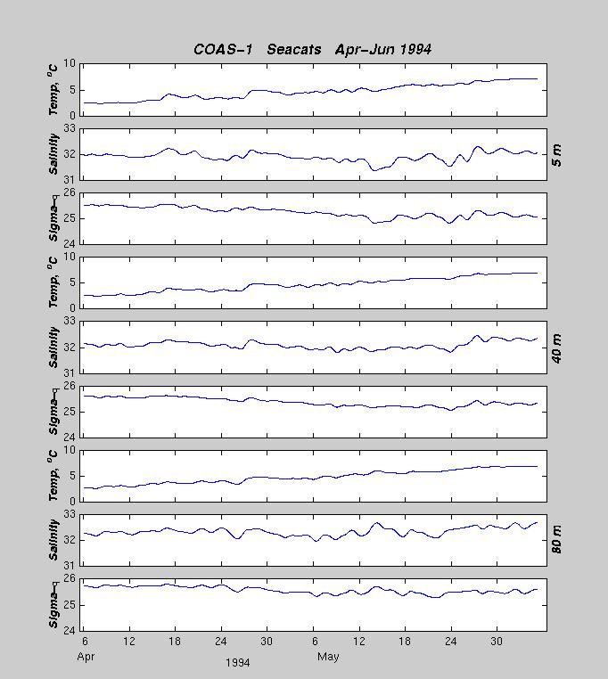
| COAS-1 | Vel,T/S | 44° 17.24´N | 067° 40.92´W | 94m | 03 Apr 1994 | 05 Jun 1994 | OK |
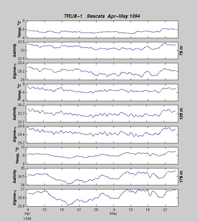
| TRUX-1 | Vel,T/S | 43° 04.62´N | 067° 34.86´W | 193m | 04 Apr 1994 | 05 Jun 1994 | Float broke free during 1st month |
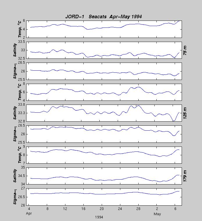
| JORD-1 | Vel,T/S | 43° 57.17´N | 067° 44.86´W | 194 m | 04 Apr 1994 | 05 Jun 1994 | Float broke free during 1st month |
| 1995 RMRP | 1996 RMRP |