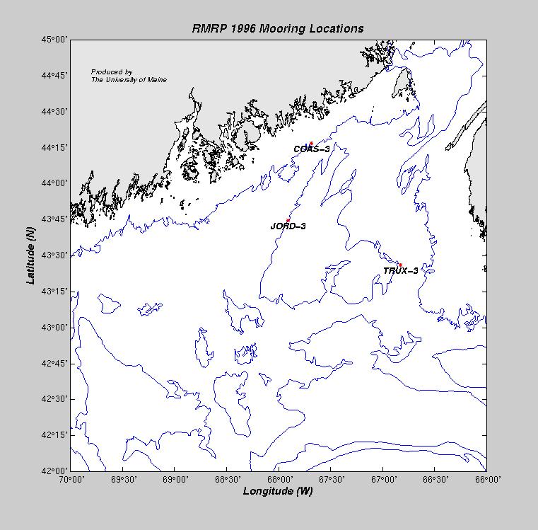
| BUOY | Data | Latitude | Longitude | Depth | Deploy. Date | Recov.Date | Comments |
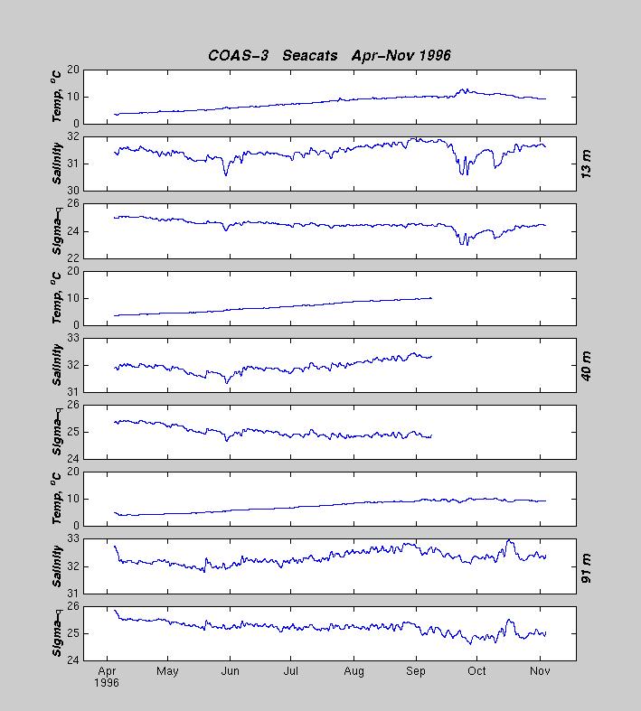
| COAS-3 | Vel,T/S | 44° 16.96´N | 067° 40.89´W | 94m | 03 Apr 1996 | 05 Nov 1996 | Doppler failed May 96 |
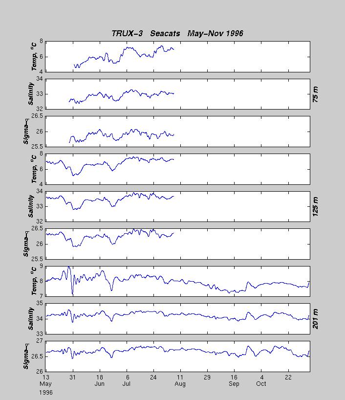
| TRUX-3 | Vel,T/S | 43° 26.12´N | 066° 49.85´W | 193m | 11 May 1996 | 05 Nov 1996 | Trawled by FV, float broke free |
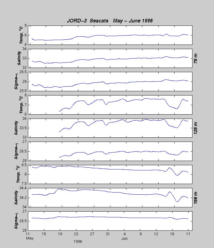
| JORD-3 | Vel,T/S | 43° 44.626´N | 067° 54.37´W | 194 m | 10 May 1996 | 05 Nov 1996 | Trawled by FV, float broke free |
| 1994 RMRP | 1995 RMRP |